Project C05.2018: Leveraging High-Resolution LiDAR and Stream Geomorphic Assessment Datasetsto Expand Regional Hydraulic Geometry Curves for Vermont: A Blueprint for NewEngland States
Leveraging High-Resolution LiDAR and Stream Geomorphic Assessment Datasets to Expand Regional Hydraulic Geometry Curves for Vermont: A Blueprint for New England States
Project C5.2018
Project Summary
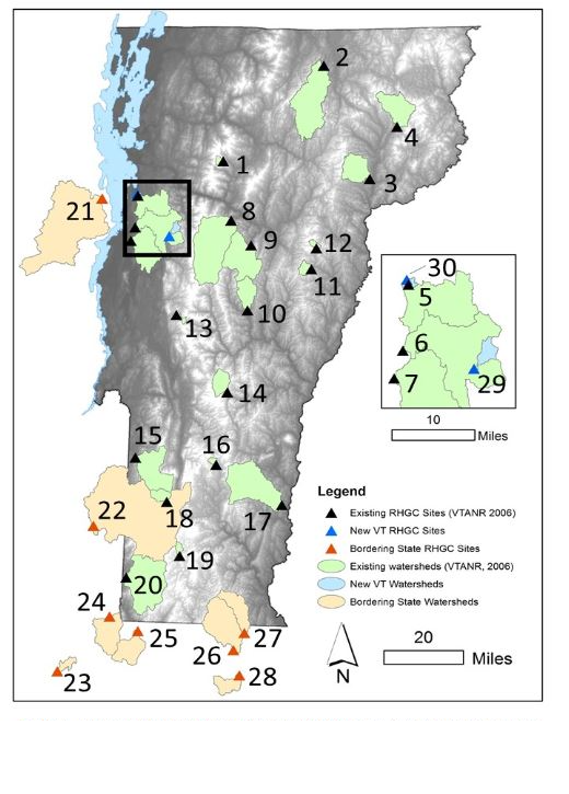
Regional hydraulic geometry curves (RHGCs) for Vermont have been updated through development of additional observations and use of newly-available high-resolution lidar and stream geomorphic assessment data to improve the prediction ability and reduce estimation uncertainty of bankfull channel dimensions for ungauged sites. Through literature review and data compilation, we have identified 10 additional observation sites with sufficiently robust geomorphic assessment data and co-located streamflow monitoring records. Application of RHGCs has been expanded to cover drainage areas up to 396 (from 194) square miles. Stratification of the curves by channel slope at a threshold of 0.1% improved prediction of bankfull width as a function of drainage area. Targeted geomorphic assessment field work and establishment of temporary streamflow monitoring stations under future funding would enable further expansion of RHGCs to better address very-low-gradient channels and add coverage for steep-gradient streams.